Walking Routes
pantón
“Pantón é un país de vales como maus abertas, de colos maternais e amorosos, de montañas docemente femininas que se erguen
para ollar ó ceo e ó inmenso Val de Lemos deitado ó seus pés, fermoso e longo.
Eiquí a pedra fíxose arte, flor, pasmo, marabilla, milagre, eirexa, castelo, mosteiro, pazo, casa, para darlle ó home seguridade e fogar, fronte ó desamparo da vida e do destino”
Manuel María
Nature
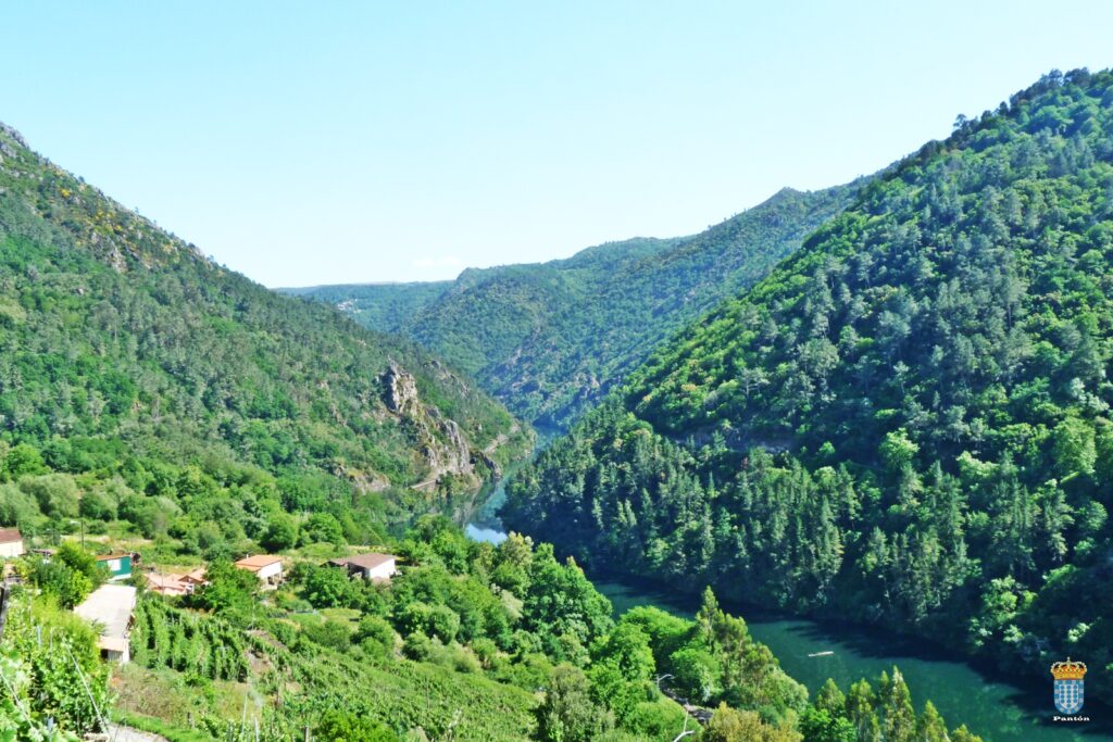
The rivers that form the boundaries of the council of Pantón (Cabe, Sil and Miño) have wild, steep banks forming a stunning natural landscape which is enhanced by its rich architectural treasures. From the highest point of the council (Pena Pombeira, 710 metres), Pantón will delight you with its beautiful views of steep river banks and peaceful valleys.
A beautiful, varied landscape with good conditions for fishing. Along the rivers Miño and Sil you can take boat trips that allow you to gaze upon the beautiful scenery of the Ribeira Sacra, with its characteristic vineyards set out in terraces called socalcos.
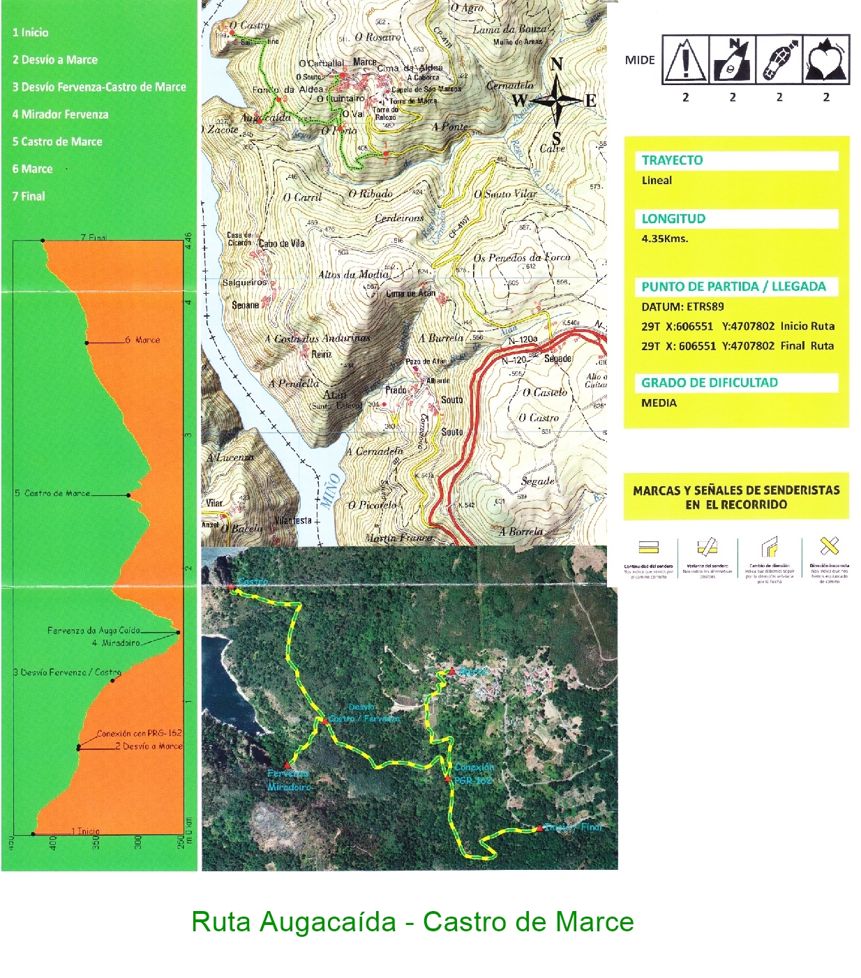
Walking route Castro de Marce - Cascada Augacaída
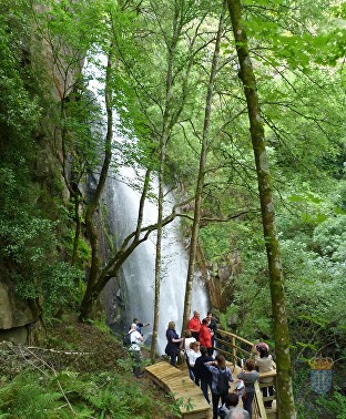
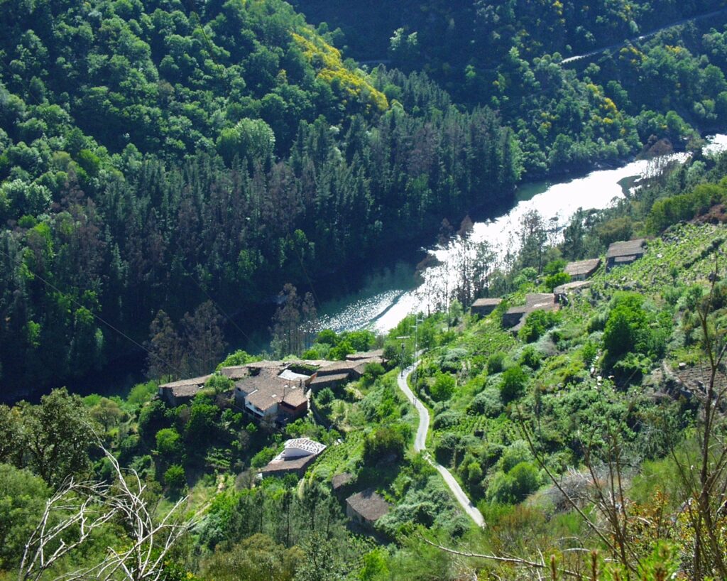
From the main town of Castro de Ferreira, take the N-120 towards Ourense. At the top of Guítara, a turn off takes you onto the old N-120a road, and from there you head towards Marce. After going down towards the river Miño for 2 km through lush vegetation, you will find the sign for the start of the route900 metres from the start in front of an old stone bodega you will see the sign for the turn off to descend to the waterfall CASCADA DE AUGACAIDA (29T X:605875 Y:4708134). After a short walk you can opt to only visit the upper part of the waterfall or if you prefer you can descend to the bottom of the waterfall.If you don´t turn off to the waterfall and continue on the route, the path will take you to CASTRO DE MARCE, a hill fort overlooking the river Miño. Its advantage point provides wide, spectacular views of this stretch of the river.In addition to the walk, you can visit Marce, where there are remains of a clock tower, a building built by emigrants to South America from this hamlet in the previous century.
Walking route la Curuxeira
To start this route you can leave your car in the campo de la fiesta (main square) in San Fiz de Cangas. To get to this point from Castro de Ferreira,
you need to take the turn off for Lornís, Frontón and Deade. After 300 m, past Serode, you will see a turn off to
the church la
iglesia de San Fiz de Cangas and A Martiñal. Stay on this road and you will arrive at the starting point which is easy to find when you see the recreation area and a shrine that houses a faithful copy of a 14th Century Calvary.
Close to this (100 m) is the Romanesque church of San Fiz de Cangas (12th Century), you approach it on a path to the north of the church. If
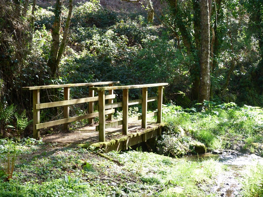
you take the path that goes south, above the recreation area, it will take you to Arribada. At the bottom of this hamlet is the start of the route. An information panel shows the route. A few metres from the start, going down towards the right, is the turn off to the spring of Augas Férreas (a spring which contains traces of iron in its waters that in past centuries was sought after for its ability to alleviate anaemia). As you continue to go down, you will arrive at a point with two alternative ways, either to continue the path and arrive at Pacios (Espasantes) or to cross a small bridge and go to A Cal (Espasantes); whichever way you go, after a short stretch on the road, you will find the path that takes you back to the start. You can also decide to start the route in A Cal or from Pacios and do it the opposite way. Almost all the route is amongst trees and vineyards. At some points along the way you can see the canyon of the river Sil and the neighbouring council of Sober.
Walking Route Cibrisqueiros a San Cosmede (Pombeiro)
It starts in Cibrisqueiros (Pombeiro), next to a communal washing area by the road and from here you take the path towards Souto. Along this path you have a lovely view of the Romanesque church of San Vicente de Pombeiro (12th to 13th Century), an example of the typical architecture along the riverside. A short uphill stretch, passing a stream, takes you to the huts of Pedén and a few metres further on, on the right, are the TUMBAS DEL PREGUNTOIRO (two tombs and the remains of others in a characteristic anthropomorphic shape excavated out of the rock)
Then you begin to descend along the river Sil, between granite rocks, possibly from the remains of a glacier. At the base of these rocks you come to PENAVEADA.
From this rock, the path descends to SAN COSMEDE at the end of the route. The path takes you through lush vegetation with a Mediterranean microclimate. Here you can see growing, blackberries, figs, lemons, oranges, olives, vines, peaches alongside cork oaks, chestnuts, pines and acacias.
Along the way it is common to see eagles, lizards, rooks and with a bit of luck deer, wild boar or foxes who will quickly disappear when they sense your presence.
This route is very beautiful but it is especially stunning in autumn and spring due to the display of colours along the riverbank at these times of the year.
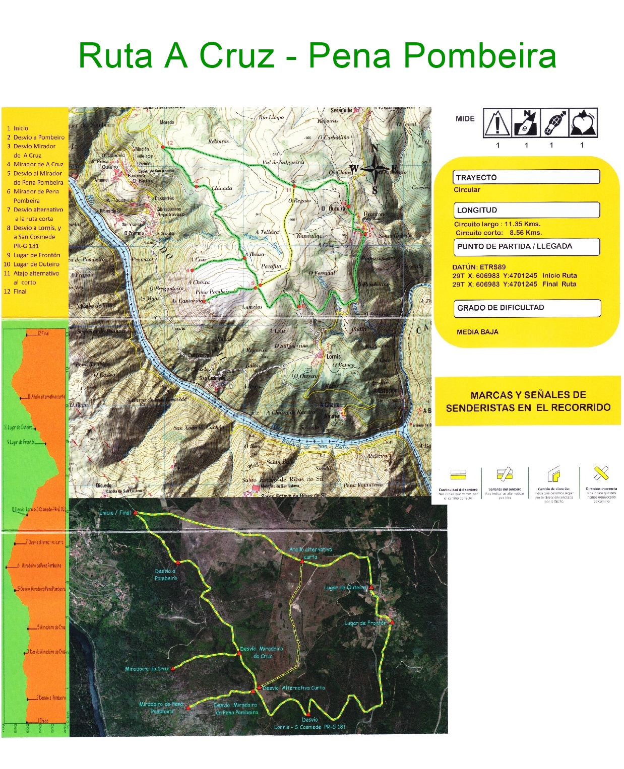
Walking route A Cruz - Pena Pombeira
This route takes in the land of the parishes of Frontón and Pombeiro, on the riverbanks of the Sil and Cabe.
You can reach the start of the path by leaving the centre of Castro de Ferreira, in direction of Deade, Frontón and Lornís. After passing Seragude and before the main square campo de la fiesta of Frontón a road on the right takes you to Ó REGUEIRO. A track turning off to the left takes you into the countryside where you can leave your car and start the walk.
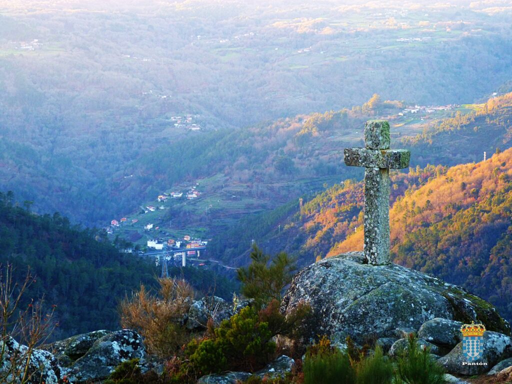
The route starts on a mud track until you reach a turn off that says A CRUZ (29T X:608009 Y:4699844). A place with beautiful views over the river Sil and the terrain of Lugo and Ourense. It gets its name from a stone cross on the hillside in remembrance of a mission that took place in the first half of the 20th Century in the parish of Pombeiro.
Returning along the path you once again come to the turn off and continue going uphill. After 200 metres there is a sign for the path to the viewing point of PENA POMBEIRA (29T X:608145 Y:4699467). It is located at the highest point in the council (707 m), it is an idyllic viewing point from which to see the river Sil in its splendour, the monastery of Santo Estevo to the left, as well as the regions of Nogueira de Ramuín, Chantada, Carballedo and Monforte de Lemos. And, even further, O Caurel, Castro Caldelas and Manzaneda.
It is worth taking time to walk through the rocks, the remains of a glacier, where the rocks over time have taken on a range of interesting forms.
After returning to the main path there are two options:
– Continue in the direction of the road Ferreira–Estación Santo Estevo (29T X:608691 Y:4699234)amongst leafy vegetation and visit Frontón and then to retake the track towards O RIGUEIRO arriving back at the start.
-Or to turn off to the left (29T X:608206 Y:4699504) taking the track towards O RIGUEIRO and returning back to the start of the walk. This route is shorter but not as beautiful.
Taking this into account the route can be started at any point and finished at the same place.
Any of the viewing points can be accessed by car.
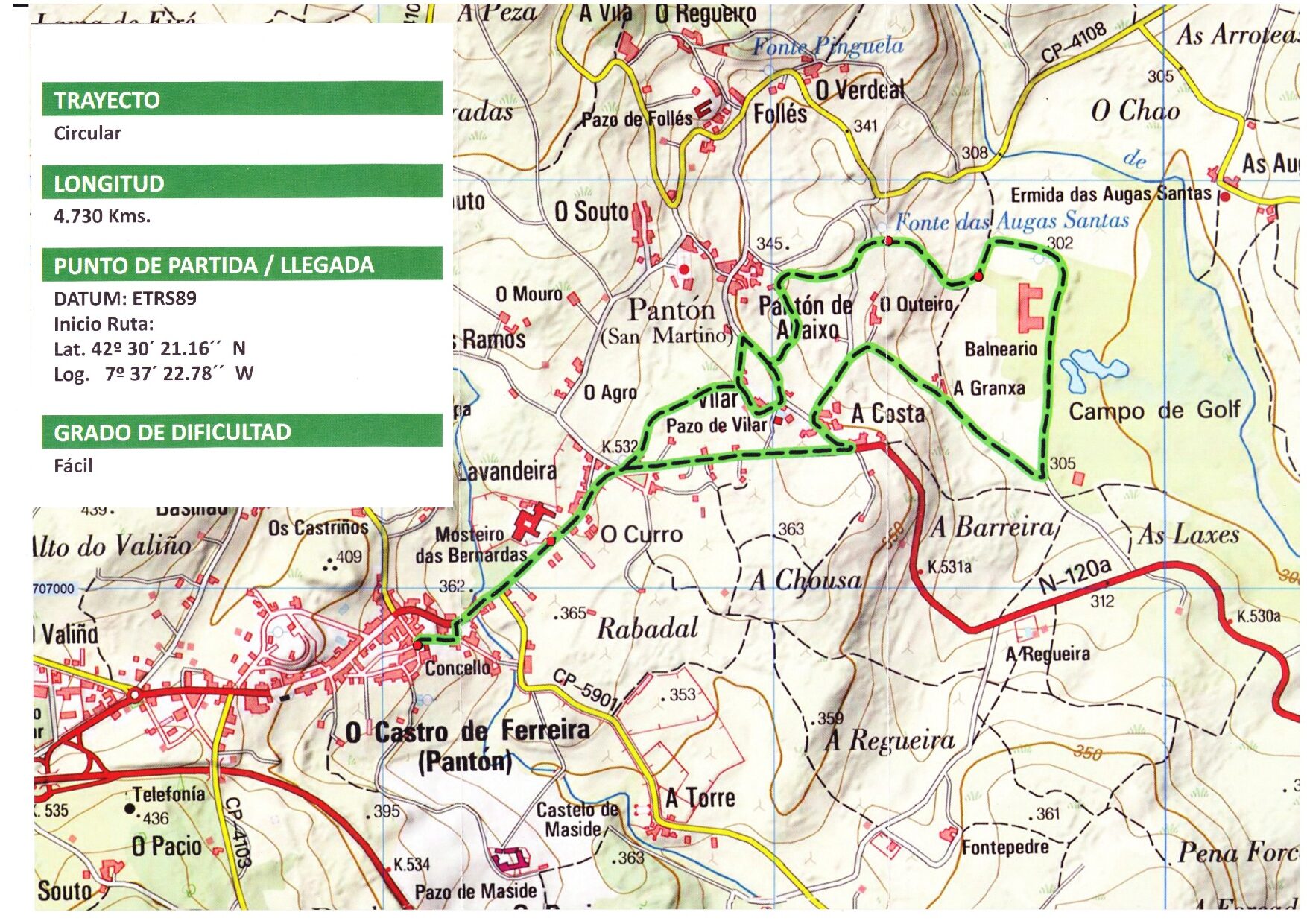
Walking Route Plaza del Ayuntamiento - Balneario Augassantas
Leaving the main square Plaza del Ayuntamiento in O Castro de Ferreira, on the N-120a towards Monforte. You pass by the monastery of the Divine Saviour Divino Salvador.
In O Curro you take a left turning towards Vilar. At this point there are two options that lead you onto a path that passes in front of a fountain of sulphurous water and that then takes you to the balneario de Augassantas (spa hotel).
From here you take a track that links to the N-120a; halfway along the track is a sign on the right that points to the path that takes you to A Granxa and A Costa, passing in front of the manor houses of Vilar and continuing onto Castro de Ferreira.
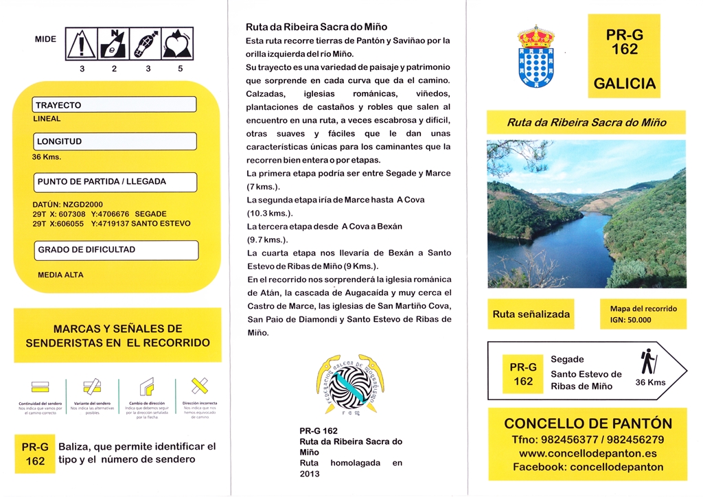
Walking route Miño (Pantón and O Saviñao)
This crosses the land of the councils of both Pantón and O Saviñao. This route is one way but it allows
you to start and finish at various points along the way as it has many access points.
The path isn't dangerous at any point but can be challenging due to the constant
up and downhill of the terrain, however it offers many places where you can leave the route along the way if you don´t wish to complete the whole trip. It is almost
36 km long and it can be broken up into various stages. We suggest 4 stages:
Stage I: Segade(x:607.441,39m / y: 4.706.896,70m)
Marce (x:606.433,28m / y: 4.708.505,68m )
Distance: 7 km
Difficulty medium to low.
Leaving on the path to the left of the road that goes down to Marce, you start a stretch through a beautiful area where you can find a water mine that in the past was used
to supply water to the houses and for watering. After arriving at Cima de Atán , in the centre of the hamlet the path starts to descend and passes close to the house of Albarde and after a small stretch along the road you arrive at the Romanesque church
of Santo Estevo de Atán.
The path continues along behind the cemetery and passes through Reiriz and Seoane. The whole way offers magnificent views of the riverbank of the Miño.
After crossing Seoane the path takes you to the upper part of the waterfall of the stream Aguianza with the option to go down to the foot of the waterfall. If you continue along the path you have the option to visit the castro de Marce, perched
above the Miño with beautiful views over the riverside and of the Romanesque church of Chouzán on the other side of the river or if you prefer you can go down directly to Marce where you can visit the clock tower and the remains of the ancient tower of the
Counts of Lemos.
Stage II: Marce (x:606.433,28m / y: 4.708.505,68m)
A Cova (x:608.844,05m / y: 4.713.136,99m)
Distance: 10.3 km
Difficulty: Medium
You start the walk in the town of Marce following the course of the Miño in the opposite direction. The first
stretch passes through a leafy Mediterranean forest after a wide track. A turn off to the left takes
you to the Maravillas (a natural esplanade that offers a panoramic view of the riverside). After arriving at
La Míllara (a recently renovated hamlet), you follow the signs to Balboa, and here between vineyards
you go down to the recreation area of A Maiorga, where it is possible to swim in the river or have a drink in the bar. After
going down, the path goes through vineyards and crosses streams until you arrive at Ribeiras de Miño the last hamlet in the council of Pantón before entering O Saviñao to visit Arxuá and finally to the church of A Cova which is the final stop of this stage.
Stage III: A Cova (x:608.844,05m / y: 4.713.136,99m)
Bexán (x:605.279,23m / y: 4.715.696,70m)
Distance: 9.7 km.
Difficulty: Medium-high
From the church of A Cova (12th Century) you take the path signposted towards Seoane which turns
off down towards Adegas Moure (Abadía da Cova), or if you prefer you can walk along the road from the
the church to the bodega. Whichever way you take, you can enjoy the magnificent view over the “Cabo do
Mundo”. You continue going down and you take the path that is signposted to the beach playa at A Cova
going through an area of forests and vineyards (it is important to look out for the signs along this stretch) passing
through A
Reguenga and Barrio. In this area you also have the option to visit the Castro de Mourelos that is off the signposted
path. After going through O Mato you are in the parish of Mourelos. Continuing along the path
you come across the ruins of the house of A Pena de Quil a once important house where you can still see the primitive decorations in the courtyard
with motifs of poultry in plaster on the stone base. After a few metres you arrive at Bexán, the end
of this stage.
Stage IV: Bexán (x:605.279,23m / y: 4.715.696,70m)
Santo Estevo de Ribas de Miño (x:606.189,57m / y: 4.719.423,22m)
Distance: 9,7 km
Difficulty: Medium
Bexán is another charming place as much for its local architecture as for its view over Belesar and
the river.
Following the signposts along the path you go down through the vineyards to the upper part of Belesar
(a little bit further down is a bar where you can take refreshments) in order to go up the path from Belesar
(a paved path from the Roman era and used in the Middle Ages as part of the pilgrim route camino de invierno or winter way to Santiago)
arriving at the Romanesque church of San Paio de Diomondi and the bishop´s palace.
Continue going up until Montecelo where there are the remains of the church of Nuestra Señora del Camino (17th Century) and
continuing on to Galegos de Diomondi and from there to Santo Estevo de Ribas de Miño where you will find the Romanesque church
of the same name and a country hotel. This is the end of the stage.
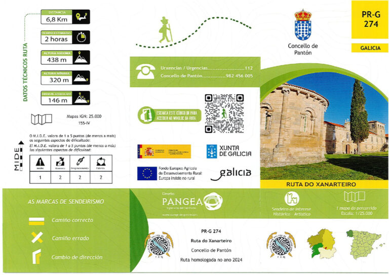
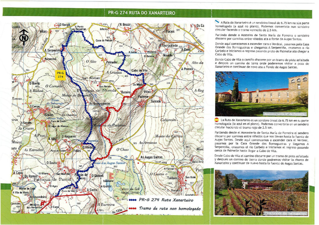
Ruta do Xanarteiro